NISAR is no ordinary satellite mission. It is a joint effort between NASA and ISRO, in which the most advanced radar systems of both agencies, NASA’s L-band and ISRO’s S-band, have been installed on a single satellite. It is scheduled to be launched on July 30, 2025 from Sriharikota, and its purpose is to closely and continuously monitor the changes taking place on our Earth.
The full form of NISAR is NASA-ISRO Synthetic Aperture Radar. In simple words, this is the first satellite in the world that will do SAR imaging at two different frequencies, that is, it will take clear and deep images of the earth. This means that it can take clear pictures of the Earth even through clouds, in the dark of night and in rugged terrain. Be it slowly sliding hills, melting glaciers or cracks in the earth’s surface, NISAR will keep an eye on everything.
The special thing about this mission is that it will not only be used for research, but will also help in understanding and solving problems directly related to the lives of common people. This satellite will take pictures of the same place once every 12 days from an altitude of 747 km. Its 240 km wide radar scan capability enables it to monitor very large areas, and that too while capturing movements within a few centimeters.
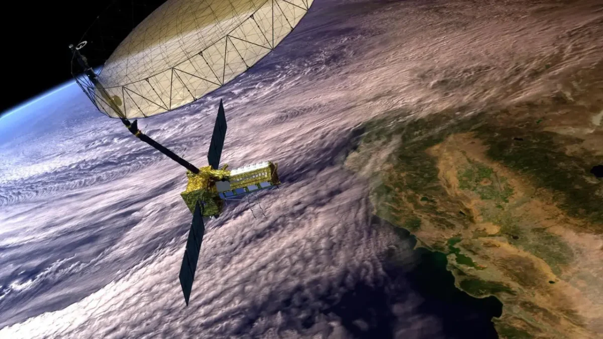
Technically, NASA has built an L-band radar, a 9 meter long boom, and a 12 meter reflector antenna for this mission, which will open up after going into space. ISRO has taken full responsibility for the satellite’s structure, S-band radar, power system and launch. After the launch, both agencies will work together in data processing, and the good thing is that its data will be free and open-source for scientists all over the world.
Another great feature of NISAR is its ability to capture full polarimetric and interferometric SAR data, allowing it to track very small changes, like land subsidence, deforestation, glacier shrinkage, or a river changing course. Its data will be used in areas like climate science, agriculture, urban development, and natural disaster management.
The mission will send data continuously for at least 5 years. This will help in predicting disasters like floods, earthquakes, and droughts. And since it will cover the whole world, it will also monitor remote areas that are difficult to reach, like the Arctic region or small islands.
The most special feature of NISAR’s technology is its SweepSAR mode, which gives high-resolution data even after scanning such a wide area. And its 12-meter radar antenna, which will open like an umbrella in space, is an engineering marvel in itself.
This mission is not just an example of partnership between NASA and ISRO, but also shows how the right use of space technology can play an important role in solving the problems of the Earth.
Scipuz’s Take
Clearly, NISAR is not an ordinary satellite, but a report card machine for the Earth with updates every 12 days. This is a proud moment for India, as ISRO is leading such a major scientific mission in collaboration with NASA for the first time.
Its data will greatly help in flood management, improving agriculture, monitoring Himalayan glaciers, and preparing for hazards like earthquakes. And the best part, its data will be available to all for free. This means that India’s students, scientists, farmers, and policy-makers can all benefit from it.